I originally posted this in another feature request thread but the more I think about it the more I am not sure that my idea is in the same vane as theirs. So here it is on its own.
I would love for there to be an invisible or at least semitransparent map object, the shape of which is fully customizable. A free-hand drawing would accomplish the same purpose. With that we could divide a map into different sections by overlaying it with one of these objects so that a sub-map would be opened by simply clicking anywhere in the shaded area of the semitransparent object. The map on the left is one of my maps and I would love to get rid of all of those "traffic light" objects (custom object I created) which are all embedded sub-maps and replace them with a semitransparent overlay that I can mold to fit exactly to the geographic area it represents. Right now, if you click on any of those objects it will go to another map that zooms in to that area on this map and show every node within that area along with their respective fiber paths. The map on the right is one of the embedded maps represented by one of the large traffic lights on the left map. Yes, my job is to provide network connectivity to traffic signals.
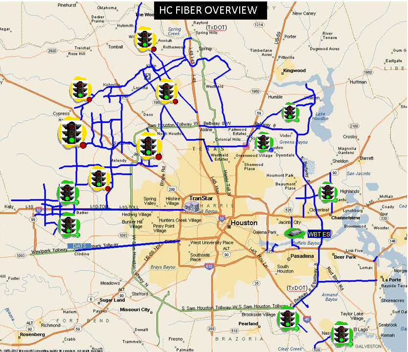

With this feature I could create a much cleaner map that shows the major road corridors
I will try to create a representation of what this would look like if I had my way. If I'm able, I'll post that here later.
Would anyone else find this useful?